 ← PreviousA cycling adventure in the Rockies for a birthday
At 7 the alarm goes off and we struggle to surface. Still, we can't take too long, because the clock is ticking and every passing minute brings its stream of cars full of holidaymakers come to enjoy the sublime Lake Louise. If you type "Canada" into Google, there's a 99% chance one of the first image results will be a photo of this lake, so iconic and world-famous is the place. We're planning a long 20-kilometre, seven-hour hike on the heights, offering breathtaking views of the turquoise lake and the valley. Our loop starts with a 4-kilometre climb to the Lake Agnes Teahouse at 2,100 metres. Our speaker and bear spray won't be any use today: even though it's only 8 am when we hit the trail, there are already lots of tourists. Most are wearing totally unsuitable shoes and clearly aren't great walkers, and we overtake many of them, worn out by the 400 metres of climbing.
Arriving at the top after about an hour's climb, we discover this little high-altitude lake and its rustic teahouse, already overrun at only nine in the morning! There's a queue and everyone is crowded around the little chalet. What makes this teahouse so popular that tourists who never walk climb up to it? Built in 1901 by the Canadian Pacific Railway, originally as a shelter for hikers, it now offers more than a hundred varieties of tea from all over the world, made with glacier water from Lake Agnes (boiled first to kill any bacteria). The staff are mainly students on their summer holidays who live on site. Because of its location, all supplies are brought up by the staff on foot or on horseback. The teahouse is apparently very popular in Canada for its delicious pastries.
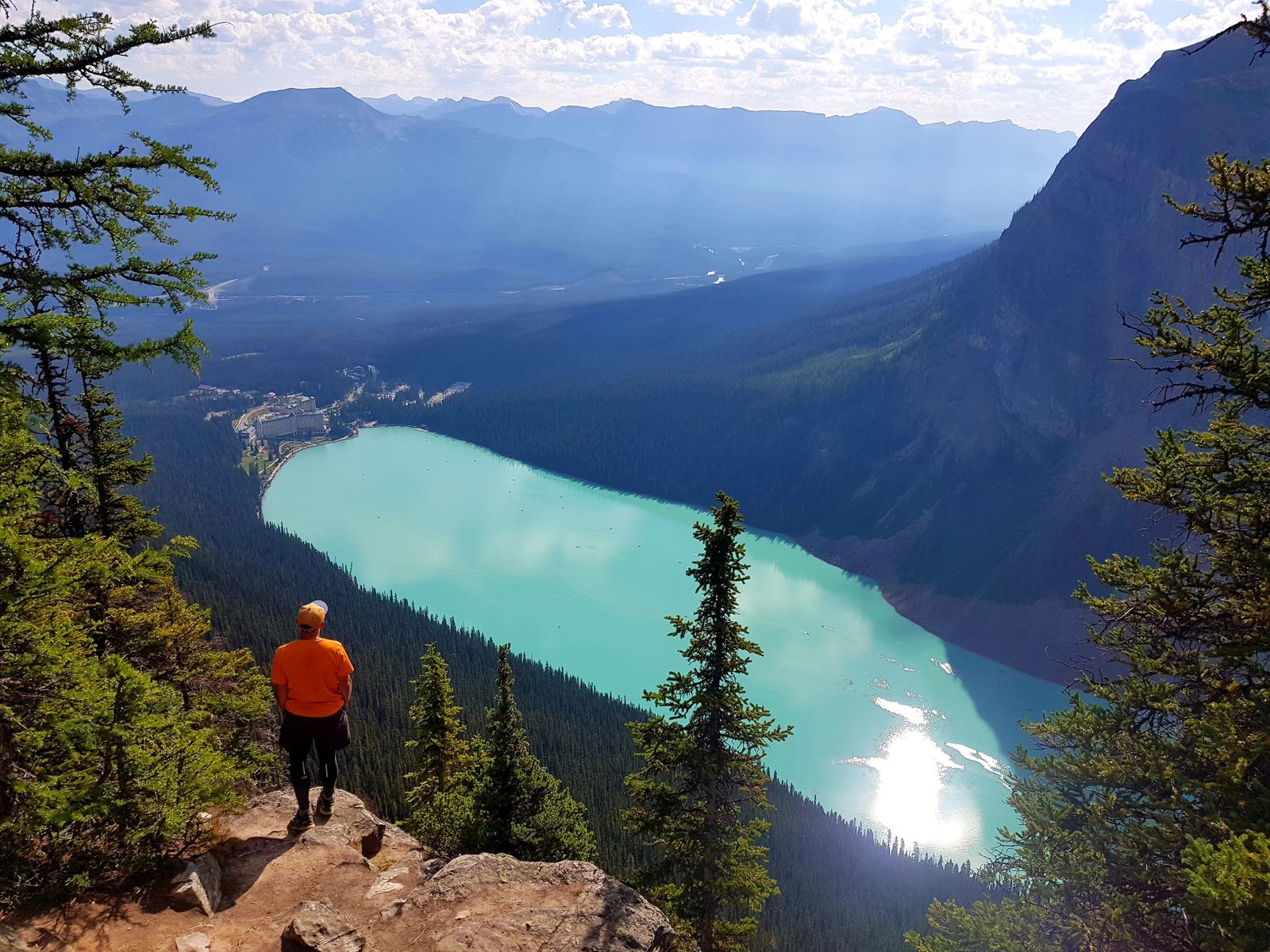
We skip the tea and cakes and carry on away from the tourists, going around Lake Agnes to climb to the Big Beehive viewpoint. The slope is steep and the climb gets the heart racing, but it only lasts about twenty minutes. There are already far fewer of us here. This viewpoint is quite popular because it offers a complete view of the turquoise waters of Lake Louise below, and you're dazzled by the unreal colour of the water! Some people of course take the chance to get their best Instagram shots. We go down the other side of the ridge to join the Plain of Six Glaciers trail. Most walkers choose either the climb to the viewpoint and Lake Agnes or the glaciers trail, but you can link the two hikes and make a big 20-kilometre loop.
The path takes us to the end of the valley, up to several glaciers whose meltwater pours into Lake Louise a little lower down. It's the sediment in that water that gives the lake its intense turquoise colour. After seven hours of walking, we're back on its shore and follow it to the car park to get back to our car. Lake Louise isn't really set up for swimming, and even if you wanted to, the water is so icy that swimming would be almost painful. There's actually hardly any infrastructure around the lake apart from a kayak rental stand at prices ten times the Canadian average and a huge, very ugly luxury hotel belonging to the Fairmont group that completely spoils the beauty of the place. How could the authorities allow such an aberration next to a natural wonder like this?
We go back to the village and head off for a very quick wash by the river. We don't stay in for long, just enough to freshen up. We also go to the
park campsite (full for ages) to fill our water jug. Dinner will be frugal, and we go back to park in our little side street.
Waking up at seven the day before was painful, but today's is even worse. It's the price to pay for access to the magnificent Moraine Lake. Its car park only holds about a hundred vehicles, and those who arrive earliest get to enjoy it first. At five the alarm goes off and we don't waste a minute getting on the road. We're still half asleep, so Stéphane drives slowly up the mountain road that winds to the lake. It's pitch dark and we even spot big caribou at the edge of the forest. When we reach the car park around 5:15, there are already lots of cars parked and we're almost at the far end. We don't get out of the car straight away: we fall straight back to sleep and only surface three hours later.
Outside Covid times, if you want to avoid a dawn wake-up, you can take a free shuttle from the village centre to Moraine Lake. We completely understand it being suspended in these exceptional circumstances, but once again it's public services that get cut first, because another shuttle, a private one, runs the same route for the modest sum of 25 dollars a head. Public-health concerns obviously stop where the lure of profit begins. Moraine Lake is less crowded than its neighbour Lake Louise, but it still has its share of tourists. We know that as soon as the trails start to climb we'll find the calm of the forest again, so we hurry to join the path to Sentinel Pass at 2,600 metres. Hike after hike, we notice that whenever we set off on a physically demanding trail, there are always Québécois around. They'd struck us as a very active people, and this only confirms that impression. Several of them are around us as we reach the pass, also enjoying the view of these exceptional mountains.
On the way down, we make a detour to Eiffel Lake, a high-altitude lake ringed by peaks, but we don't linger because it starts to rain. In the mountains, as everyone knows, the weather is unpredictable and changes very quickly. At 3 pm we're back by the lake and eat our lunch, a pasta and tuna salad made the day before. We then head back to the town campsite to wash in the toilets. Not being campsite guests, we're not supposed to go in, but the lack of facilities for travellers in Canada pushes us into a little illegality that makes us laugh. It's nothing very wicked, and we leave fifteen minutes later. We leave the village of Lake Louise and take the slip road onto Highway 93, better known as the Icefields Parkway. This magnificent scenic road, one of the most beautiful in the world, winds through the heart of the Rockies across Banff and Jasper national parks, running north–south for 200 kilometres.
Along this road to the town of Jasper there are plenty of unstaffed campgrounds where you register yourself day by day, but the first two we find are either full or closed because of Covid. After 80 kilometres, we reach a place called Saskatchewan River Crossing, a rest area where two roads meet and the Saskatchewan River flows. Tired and fed up with searching, we decide to park in one of the parking spaces of the motel there and spend the night. However, we spot a big gravel area to the side and a young man busying himself around his van, clearly a backpacker like us, and we ask him whether it's allowed to sleep here. We ask in English, of course, and immediately notice his accent. The young man is French, his name is Maël, and he confirms it's perfectly fine to stay parked there for the night, free of charge. His girlfriend Cindy soon joins him and we chat all evening over beers and a basic campers' meal: flageolet beans, pasta and sardines. They're both from Nantes and have made more or less the same trips as us in recent years, including a year in Australia, which gives us plenty to talk about. We're truly in the middle of nowhere, surrounded by imposing mountains, and only the cold and the dark bring this pleasant evening to an end.
On the trail