 ← PreviousVisiting Québec City: culture, food and landscapes
2 October
Jacques Cartier is an unavoidable figure in Québec. The first official discoverer of Canada, he documented his voyages so thoroughly that it's easy to follow in his footsteps. The Jacques-Cartier River bears his name because he is said to have sailed up it around August 1536, as does the national park we went to that day. Thirty minutes from Québec City and covering 670 square kilometres, this wild area is known for its hiking and kayaking. But even before we got there, we caught sight for the first time, along the highway, of one of the classic images of our new adopted country: multicoloured forests already wearing a splendid autumn coat. We couldn't hold back a sigh of admiration when the landscape revealed itself from the top of a rise, with colours straight out of an old master's painting. To the sound of Latin music, we paid our entrance fee and wound slowly through the park.
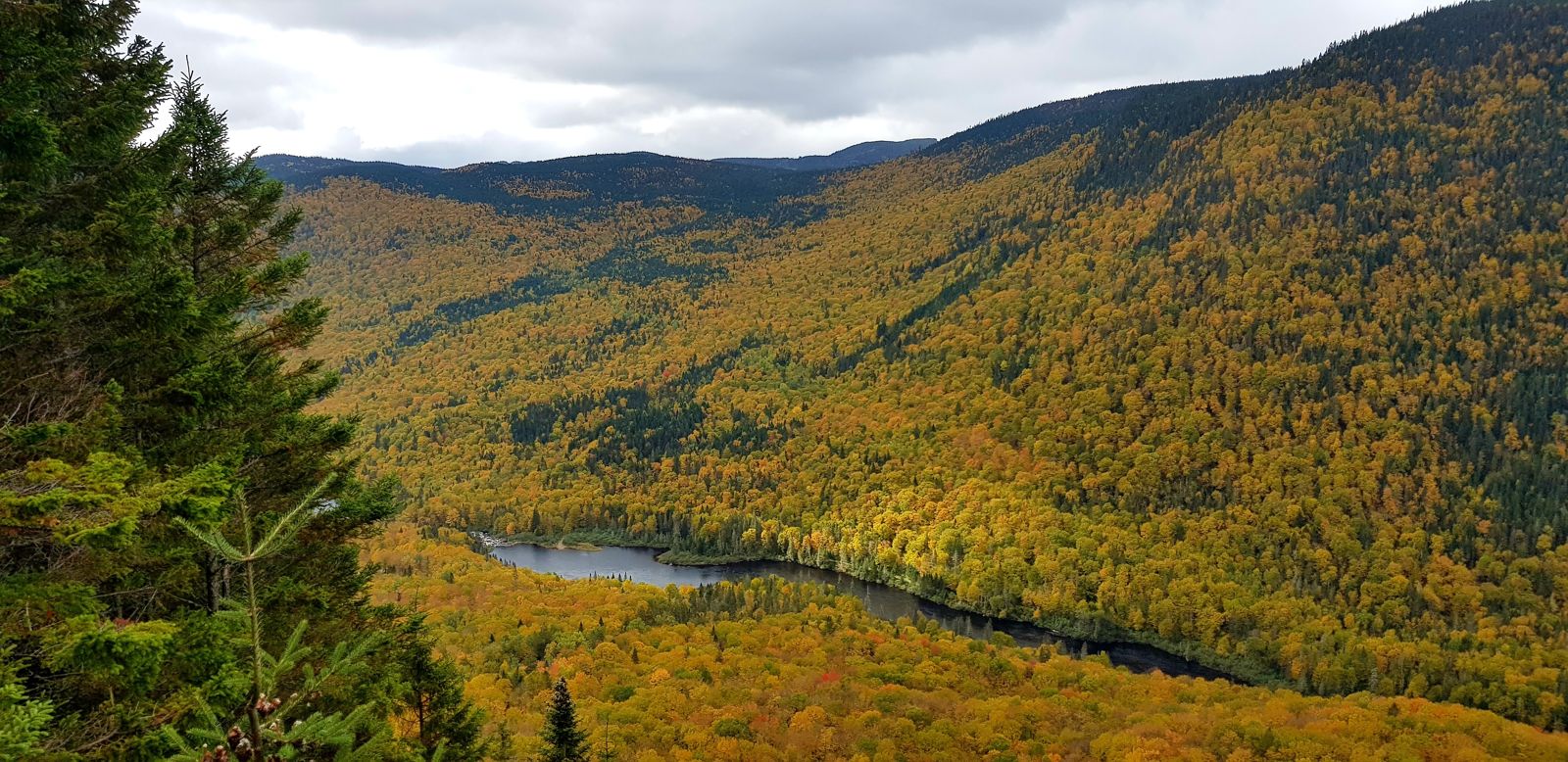
Several signs told us the risk of meeting "large wildlife" was high, and we preferred to be careful, especially as the pictograms showed moose and bears. We drove slowly through the park, enjoying the viewpoints, before reaching the Sentier des Loups car park. The trail of the same name is 11 kilometres long and rated difficult by the park administration. That kind of detail wouldn't normally scare us, but Cassandre's condition — still on crutches with a shaky right foot — made us more cautious. We started on a gentle slope and immediately appreciated the Olympian calm of the forest, where the only sound was the wind in the orange leaves and sometimes a small animal scampering along the branches.
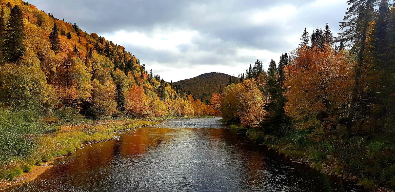
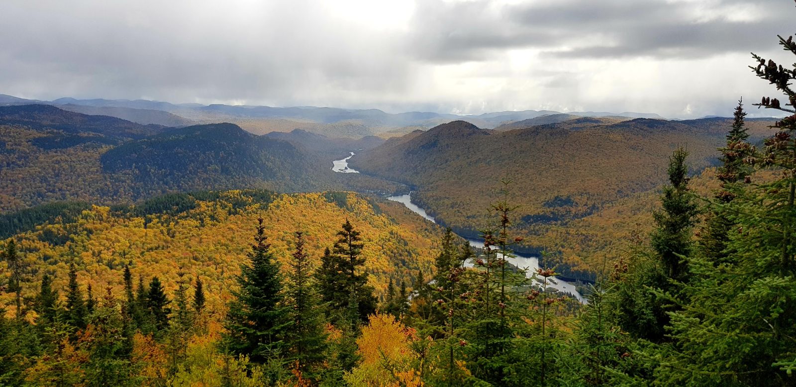
Other walkers soon joined us, and at our slower pace we were often overtaken. It didn't matter; we moved along quietly, Cassandre taking care not to make her right foot worse. After an hour's climb and the enchanting sight of a little squirrel a few metres away, we reached the first lookout, marking the halfway point of the climb. The view over the Jacques-Cartier River was breathtaking. Yellow mingled with orange, red contrasted with the evergreen of the firs, while the blue of the icy water split the landscape in two. We spent long minutes contemplating the scene, eating a cereal bar that did our bodies good while the view soothed our minds. We now knew our efforts would be rewarded at the end.
We set off again light-hearted for the second part. As we gained height, the ground became muddier and the temperature dropped. Our breath grew shorter and our motivation sometimes wavered. Many hikers overtook us, as we were moving carefully at a snail's pace. A kilometre of gentle incline let us rest a little before tackling the last part of Mont Sautauriski. We had to juggle mud, slippery rocks and wet leaves to finally reach the second lookout, which offered an even more dazzling panorama than the first. Before us, the confluence of the Jacques-Cartier and Sautauriski rivers traced an imposing fork across a horizon full of multicoloured trees. We photographed the scene from every angle and ate lunch on a worm-eaten wooden bench meant for exhausted walkers.
After two hours and twenty minutes of climbing, the descent went faster. While staying careful not to slip, we chatted about the landscape, which was becoming familiar to us, and got back to the car park in an hour and forty minutes. Glad to sit down, we got into the car to head to the Discovery Centre. It overlooked a branch of the river, and we took a few photos before heading back to the city.
3 October 2019
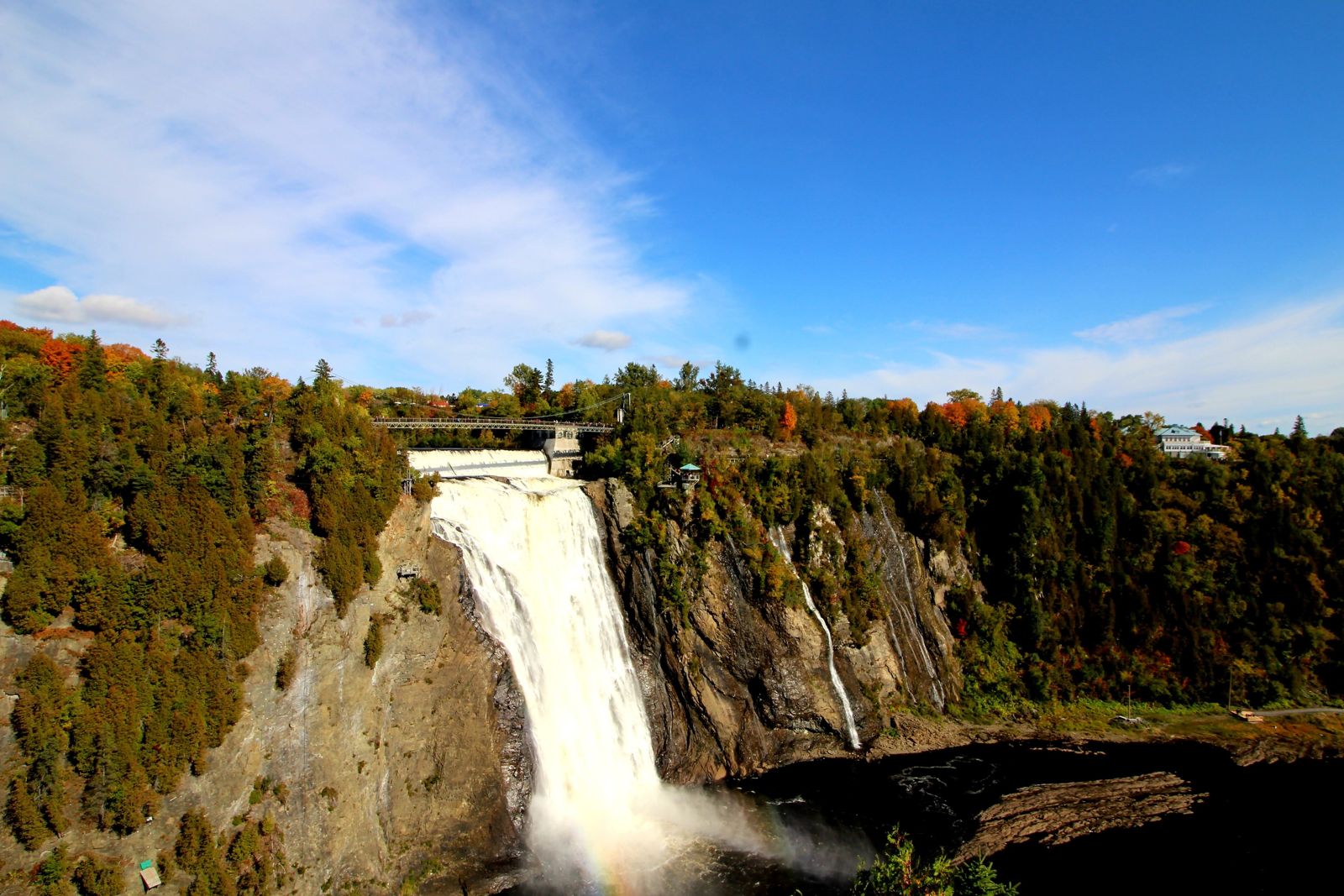
Opened on 4 July 1935, the Île d'Orléans bridge crosses the northern channel of the St Lawrence, linking the upper part of Québec City to the picturesque tourist attraction that is Île d'Orléans. This 1,700-metre structure also had the advantage of linking our two points of interest for the day. On the left bank, Montmorency Falls announced itself with a deafening roar. We parked at the foot to admire it from below, along with the inevitable horde of Chinese tourists and their imposing coaches. A small path let you get close enough for good photos but far enough not to get soaked by the spray. We then drove up to the top of the falls. Looking down on this natural curiosity, we truly took in the beauty of the scene around us, with all the colourful trees decorating a setting enhanced by the blue sky.
After roaming every path and filling our memory card with photos and memories, we crossed the bridge to Île d'Orléans, a farming island well known in the region. It's circled by a ring road called the Chemin Royal, a relic of New France. The island was named in honour of King Henri II, Duke of Orléans, when Jacques Cartier discovered it in 1535. Visiting the island was simple: you just followed the road and stopped wherever you liked. Left and right we found orchards, vineyards, cheesemakers and little villages, each more charming than the last. The people of Québec City know a good thing when they see it, and many of the typical houses we passed were in fact second homes for holidays and weekends.
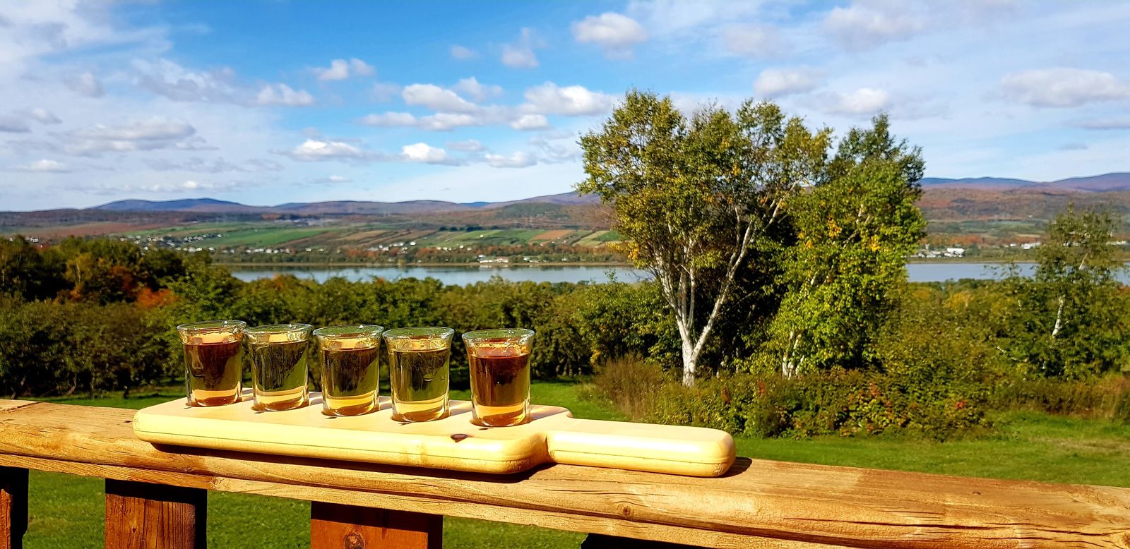
We first stopped at the Domaine Steinbach, an artisanal cider house where we tasted five different ciders. After this pleasant appetiser, we browsed the shop and left with an excellent maple onion confit and some duck rillettes. It didn't cost that much, and we were keen to support the local economy. After a simple meal at the Le Poste de Traite inn, we headed to a microbrewery where we sipped a flight of four beers brewed on site: a white, a blonde, an amber and a dark. We drove peacefully along the sometimes winding road until we reached the Saint-François observation tower, a 96-step climb for a view over the Cap-Tourmente National Wildlife Area on the other side of the St Lawrence. The view was admirable, and we left satisfied that we hadn't climbed all those steps for nothing.
A bakery, aptly named La Boulange, stood opposite the church of Saint-Jean, which we planned to visit. We took the chance to buy bread for the next day's hike. In the church, an old man stood at the welcome desk, ready to answer all our questions. We asked him in particular about the immaculate state of the place: the paint looked brand new and the pews were clearly made of top-quality wood. He told us that a wealthy parishioner had left a fortune in his will for the renovation of the church.
We then continued to the Sainte-Pétronille vineyard. Behind the counter, a man shared his knowledge of wines from all over the world, managing to make a subject that isn't necessarily captivating fascinating. Stéphane was wearing a New Zealand sweatshirt, and a conversation started about the quality of wines from the land of the kiwis. We tasted three different wines, well guided by our server, who explained the subtleties and differences of each in detail. The very first made a strong impression and we bought a bottle. It was a white wine called "Voile de la Mariée" ("Bridal Veil"), a local reference, as that's also the name of Montmorency Falls in Indigenous legends. We also learned that the legal blood-alcohol limit in Québec was 0.8 g/l, so we could get back on the road without worrying. Stéphane, who was driving, was well below the limit, since the tasting glasses were tiny, but it was still good to know.
Following Route 138 East, we reached Baie-Saint-Paul around 5:30 pm and checked into our room at the Auberge des Balcons. We'd expected a little chalet with a few rooms, but the establishment was actually in a huge former convent. It matched exactly what we imagined an inn to be: a warm place where people passing through meet for a night. While we were in the lounge writing this account, a hockey-mad Québécois sat down near us to watch the first game of the season between the Montréal Canadiens and the Carolina Hurricanes. Very talkative, he kept us company for a while before being joined by another fan of the ice sport. We then took our leave to have dinner at the little restaurant Tony & Charlo, which served bistro food in a cosy setting. Once full, we went back to the inn.
On the trail